

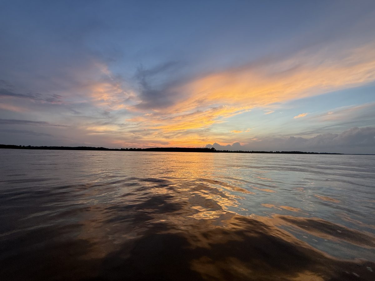
In this section of the river, The head winds in the morning are pretty harsh. The winds off the gulf can be relentless. It took me almost 30 minutes to paddle 2 miles while I argued to myself about why this was a fun idea. As the headwinds eased up and the humidity & heat of the day started to take its toll on my paddle speeds, I started looking for a place to resupply water, recharge my batteries and resupply food if possible knowing that it would be another hundred mile paddle prior to me seeing another town. I stopped at a small boat marina that had the minimum supply of power and fresh water but nothing else. By the time I fully charged all of my electronics and waited out some of the intense heat of the midday sun and started paddling down river I knew my day would finish later than I liked. My goal was to paddle to mile 498 which I knew had an island with a camping space that was above the flood water heights the river is currently at. I knew that I would be facing sunset quickly which is always a bad time to paddle as the reflection on the water makes me almost impossible to see when the tug boats head upriver. Paddling past sunset into the night can be very dangerous with the debris in the water, but I also knew that there wasn’t many spaces in this 30 mile section to actually camp along the shoreline. The sun started to fall behind the trees on the bank so I stopped to attach my lights to my boat and attach my headlamp to my hat knowing that if I lost it in the water, I’d be in bigger trouble. The sunsets along the river in this part of the Mississippi are absolutely amazing. Often the sun falls behind the thunderstorms and cumulus clouds, creating dynamic sunsets and beautiful scenery, but also the possibility of rain at some point in the night. My first hour paddling in the dark was smooth as normal. My goal is always to stay in the main channel just outside of the red and green markers staying in the faster water and free of any debris or obstacles. As I passed the first couple of barges heading upstream I stayed on the river left or typically what you would consider against traffic that way they could see my headlamp, knowing I was in the area. As I rounded a large bend in the river, I knew the campsite would be on the river right or on my downstream right so I checked the main river channel for barges in each direction and started the long paddle across the 1/2 mile wide river channel in anticipation of seeing my campsite a mile or two down river. The tree lines of the river stand out even in pitch darkness as the water reflects the starlight making it easier to see the shapes of the islands and shoreline. As I got closer to the campsite I could see the lights from a heavy equipment plant several miles in the distance, which is always a good indicator that I’ll have cell service to an extent and gave me and idea of my location on the water. Paddling on the same side of the ship channel as the barges going down river is always a little bit nerve-racking, as they are incredibly silenced until they pass you so I wanted to stay as close to the riverbank as possible. I typically would have about 100 yards of space that is too shallow for them to travel outside of the main channel providing a small safety buffer. As cell service got better, I called Sam to find out how far I was from my campsite. As we were discussing how much of the island could be underwater at flood stage, Sam noticed a large levy, extending roughly 500 yards out into the river just short of the main shipping channel which was built of large rocks and may or may not be underwater. I had to make a split second decision whether it was safer to possibly float over the top of the levy if the waters are deep enough or stay right on shore with the ability to stay in the shoreline eddie created by the tree line just above the levy to see what the level of danger was. As I approach the levy it was much louder than I expected, indicating that it was either very shallow over the top of the rocks or a very large drop with a lot of current and definitely unsafe to paddle in these conditions. I stayed within about 15 feet of shore approaching the levy when I realized that the water was just deep enough to paddle across the top of it except behind the levy was a large cut out of land, probably designed as a place for barges to stop outside the current, etc., which had instantly become a huge log jam with hundreds of full-size trees, debris & bushes all swirling around created by the eddie below the Levi. I instantly went from kayaking mode to Whitewater paddle mode. Using my past experience of currents and water knowledge and the incredibly small headlamp that I had illuminating a 10’ wide path in a football field sized debris Sam gave me GPS directions to stay navigating downstream as the Levy create a gigantic whirlpool and with no landmarks, it’s very easy to just stay in the whirlpool of debris pulled closer to the center and larger debris. Once I got through that, I realized that there was a second Levy further down stream and immediately paddle towards the deeper water of the channel knowing that was my best option in the situation. At the end of the second Levy there’s a channel marker with a reflector on it, and I knew that was the goal…. Get past that at all cost. Dig hard, paddle fast, be efficient and use the river‘s current and my boat’s speed advantage to clear that marker prior to going down River. The second Levy was not quite as long as the first, but as you get towards the very end, that forms the strongest Eddie line and most power. I dug hard driving the paddle through the water, pushing my feet against the platform in my boat using every ounce of effort to clear the outer marker and swung a wide right hand turn around the marker into the main channel with huge feeling of relief, knowing that my campsite and safety for the evening is just down river. The size of the sandbar was massive, but at this river level 80% of it was Underwater so it was a guesstimate on an exact camping spot, but I wanted to be at least a foot above the water level just in case the river rose again as I slept. I was incredibly happy to once again I fond a very comfortable sandbar with no bugs and the semi full moon allowing me to set up camp very quickly. I will call it HOME for the night and look forward to the next day’s adventures!




 .
.



Steve!!!!
OMG… You are almost there!! I take back my comment you’ll never make it. LOL
Maybe that is what kept you going??? Many people have tried to do it and failed.
We have been following you. Great to hear how close you are to the end.